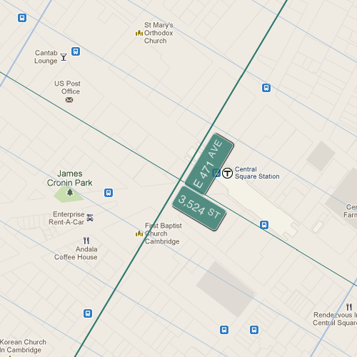
In places like New York City, you can easily measure distance in blocks and people generally know how far that is in miles or minutes. In New York City, everybody knows that Manhattan street blocks are about 20 to the mile, and most New Yorkers can walk about one such block per minute. Tourists travel a fraction of that rate and really should have their own lanes. Avenue blocks are less reliably spaced but they run about 1/4 mile each.
In less griddy places like London or Boston, a block is not always a block, so it’s less of a useful measure.
If you’re getting sick of my New York City centric pondering, you’re really going to hate this next bit. The estimable Harold Cooper has created a marvelous map mashup that extends the Manhattan street grid to “every point on earth.” It’s called extendNY, of course, and I think it’s awesome. Of course.
Now I can always know how many blocks away something is, using my beloved standard Manhattan blocks, even when not in Manhattan. I must say, I never thought I’d be spending so much time on the Upper East Side. I shall henceforth refer to the MBTA 1 bus as the 3,524th street crosstown, or the M3524.
For extra cartogeeky credit, check out what happens to the grid in Uzbekistan, which I shall henceforth call the North Manhattan Pole. That’ll teach you to slap a rectangular grid on a round thing.


Trackbacks/Pingbacks